Devices used
For effective results, which allow the collection of sufficient data to ensure greater driving safety and an optimal state of health of the driver, Safe Demon makes use of innovative IT tools:
Vehicle dynamic data detection systems
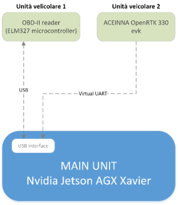
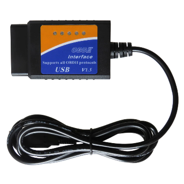 The vehicle unit 1 acquires data from the vehicle through the OBD-II (On Board Diagnostics) interface. The data transferred through this interface follow standards, but cannot be directly used by personal computers or smart devices.
 For this reason, a pre-programmed ELM327 PIC18F2480 microcontroller reads messages from the vehicle’s OBD-II port and translates the messages into RS232 signals, eliminating the ambiguity of understanding which protocol is used on the vehicle.
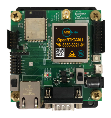 The vehicle unit 2 provides the parameters relating to the position of the vehicle. é The positioning solution uses an integrated GNSS and IMU (Inertial Measurement System) system assisted by an RTK receiver. The whole system guarantees, thanks to the integration of Real-Time Kinematic (RTK) and Precise Point Positioning (PPP) algorithms, the necessary precision even in the absence of GNSS signal (tunnels, canyons) at a measurement frequency of 100 Hz.
Biometric data detection systems
The architecture of the headset is an asymmetrical mechanical system, which can be positioned on both the left and right side of the ear.
Road context data detection systems
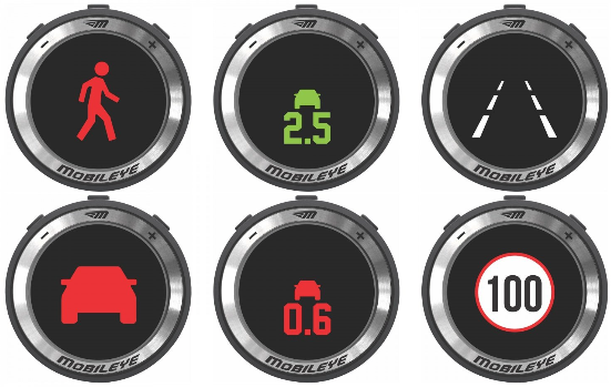 ADAS driver assistance technologies are now standard on all vehicles for the purpose of improving driving safety, and can also be a useful source of data.
In particular, in our project a commercial system was used (https://www.mobileye.com/) capable of identifying horizontal (Lane Departure warning) and vertical (speed limits, …) signs, identifying vehicles that precede (forward collision warning) or the presence of any pedestrians (pedestrian warning).
Data acquisition from maps
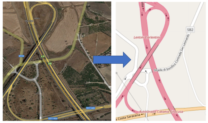 A Hw / Sw system has been developed in SafeDemon in order to provide, in real time, information on the characteristic road elements, available on digital maps supplied by third parties (eg. HERE, OpenStreet Map, Google Map, etc.), based on the information location data received from the GNSS / INS device.